A cartographical plot twist - Floris Balthasar’s map of the siege of Sluis and its missing legend reunited
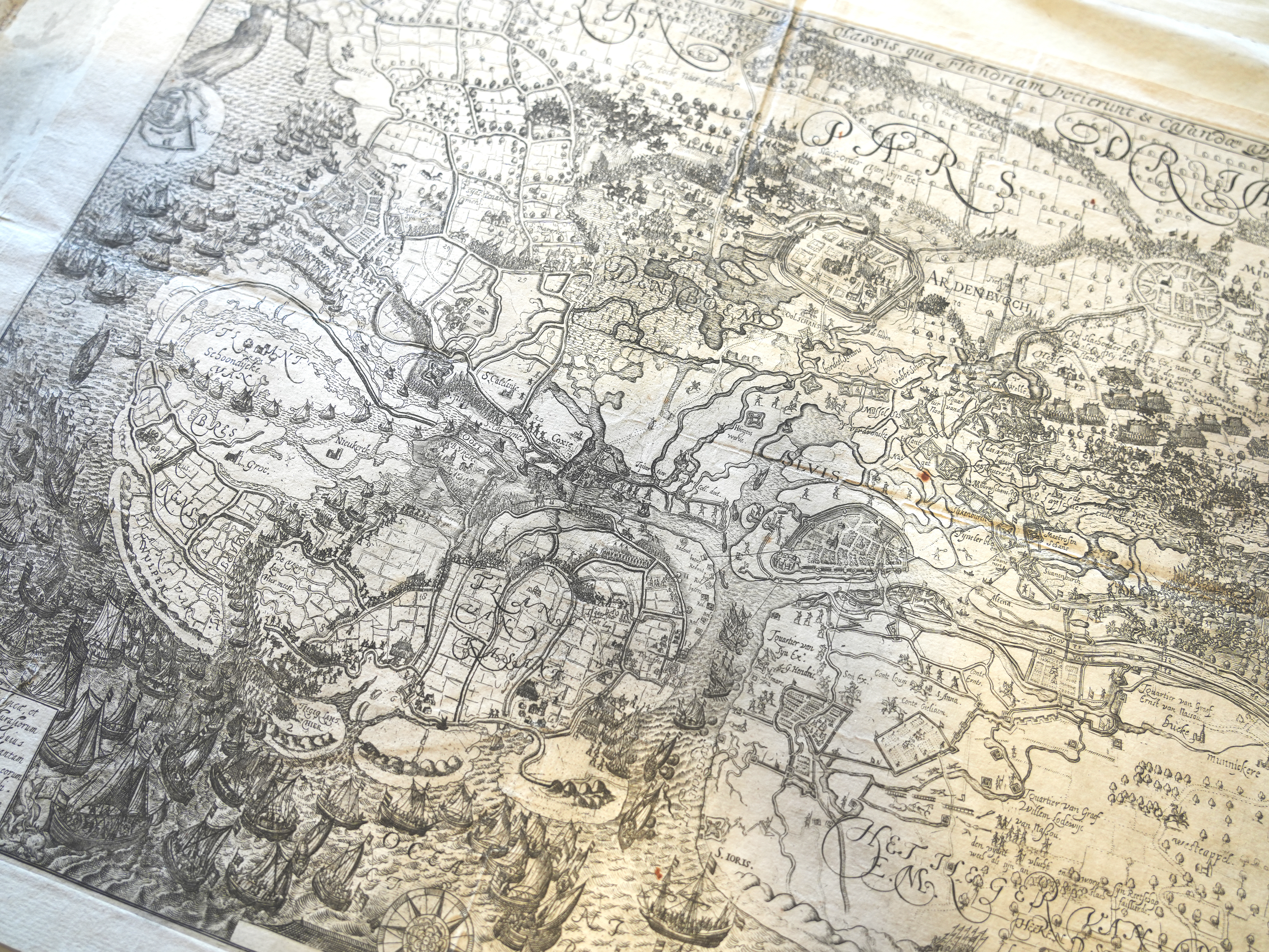
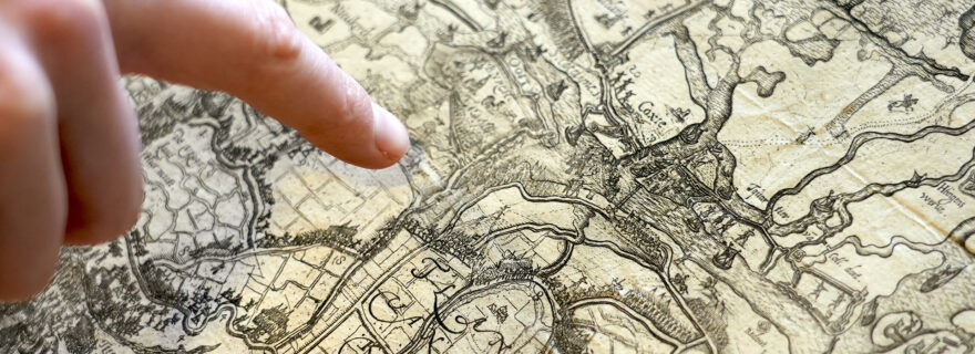
This intriguing map by Floris Balthasar, preserved in the UBL collections, depicts the story of the capture of Sluis during the Dutch Revolt. Recently, 420 years after the siege, Anne-Rieke van Schaik discovered the missing legend and explanation, shedding light on the map’s narrative and purpose.
In the early modern Low Countries, narrative cartography was a thriving new medium, used to communicate information about contemporary and past events, such as sieges, battles, disasters, and travel. In 1604, the Delft engraver, printer, and publisher Floris Balthasarsz van Berckenrode (1562/1563-1616) joined Maurice of Orange’s army during their so-called Flemish Campaign and the siege of Sluis, where he took notes and made extensive sketches of events. Back home in Delft, he developed his gathered data into an elaborate ‘story map’, a document combining narrative and spatial data to communicate a story to a broad audience.


Three copies are known of Balthasar’s map of the siege of Sluis (published in 1604), preserved in Leiden University Libraries, Rijksmuseum Amsterdam and Paris National Library. The map held in Amsterdam is considered the first state of the map. The ones from Leiden and Paris are slightly modified second states of the same document. In this second state, Balthasar added laudatory elements such as dedications to the States General and Maurits, and the personification of the fame – ‘Fama’ – celebrating the capture of Sluis. Until today, only the explanatory letterpress texts accompanying the Amsterdam map were known; the second state copies from Leiden and Paris do not contain additional printed texts mounted around the map like the Amsterdam copy has. However, during a visit to the Royal Library in Brussels, where I expected to find another copy of Balthasar’s map, I was happily surprised to find the missing explanatory text that originally accompanied a copy – an unknown copy, not necessarily specifically the one from Leiden – of the second map state.
How do we know this print originally belonged to the second map state? The first thing to note is that the sheets are bound as a four-page booklet, which was intended to be sold as such. Another striking difference is the change in title of the explanatory text. It was changed into: ‘(…) Sluys, so die belegert ende verovert is van zijn Excellentie Mauritius (...)’. By adding ‘and captured’ to the title, it is clearer that the siege was finished and won by the Dutch. The text below the title is much shorter than the Amsterdam legend and simply summarizes the town's surrender after three months. The texts on the following pages, however, are much longer, describing the sequence of events until August 17, while the Amsterdam description only runs to May 30.


Looking at just these two different texts, it seems obvious that Balthasar simply made the first version during the siege, not knowing the outcome, and the second version after the siege had concluded. However, the numbered legends as well as the information within the maps imply something else. We find a clue in the legend that is part of the Brussels booklet. Where the first legend (Amsterdam) consists of 33 numbers, referring to events until the 26th of May, the second legend has 34 numbers, of which the 34th indicates the final episode of the story and the defeat of the Spanish: ‘Hier worde den vyant gheslaghen den 17. Augusti by t Marolle gat.’ We can indeed find number 34 engraved next to a depicted battle scene near Marolle gat in the centre of the map, where the ‘enemy’ is beaten.


The remarkable thing is that this exact same scene was already present in the first state (kept in Amsterdam). So, we can only conclude that Balthasar, when creating his first state, already knew the entire story, including its ending. He even engraved all the final episodes on the map while the accompanying texts describe only half of the story, suggesting that the map shows the surroundings of Sluis in the heat of the conflict.


Why would Balthasar choose to do this? Why didn’t he just produce one, complete version of the story map containing all the known information from the story? What was the point of making two versions? One possible reason is commercial: by publishing two versions and enticing buyers to buy the follow-up to the first one, he could simply earn twice as much. But this does not explain why Balthasar re-engraved the plate into a second state, adding extensive dedications and the ‘Fama’ figure, praising the States General and Maurice. Bearing in mind that Balthasar frequently asked for compensation for his efforts and maps at the States General in The Hague, another explanation for the two issued states is more convincing. The newly discovered, accompanying text confirms an existing theory (suggested by Dirk de Vries in 2004) that Balthasar manipulated the States General to pay him more money by only adding the end of the story and the dedications to the map when they gave him extra money. It worked; he received his final payments for his ‘dedicated map’ in August 1605, almost a year after Sluis was captured.
All in all, the discovery made in Brussels has resulted in a twist in the story that reshapes both the map’s narrative and our interpretation of it: it sheds new light on the practice and intentions of Balthasar who did not primarily target a news market but rather produced memorial maps, explicitly addressing his patrons who would demand a favourable, mapped memory of their military success in Sluis.
____________
About the author: Anne-Rieke van Schaik is a PhD Candidate at the University of Amsterdam and member of the Explokart research programme on the history of cartography. Anne-Rieke studied the Leiden University Libraries Special Collections with a Scaliger Fellowship.
Further reading
Bauwens, A.R., and D. de Vries. Oorlog in het land van Cadzand in 1604: een stripverhaal van Floris Balthasar. Aardenburg: Heemkundige Kring West-Zeeuws-Vlaanderen, 2004.
Dillen, Kristiaan, and Bram Vannieuwenhuyze. ‘Bedrieglijke eenvoud: Flandria Borealis tussen kaart en historie, tussen afbeelding en uitbeelding’. Tijdschrift voor geschiedenis 130, no. 4 (2017): 521–43. https://doi.org/10.5117/TVGESC....
Vries, Dirk de. ‘Oostende verloren, Sluis gewonnen, 1604: een kroniek in kaarten: catalogus bij een tentoonstelling in de Leidse Universiteitsbibliotheek van 12 augustus-12 september 2004’. Kleine publicaties van de Leidse Universiteitsbibliotheek, nr. 61. Leiden: Universiteitsbibliotheek Leiden, 2004.


